Zero-Shot Detection for Automatic Mapping of Illegal Roadside Waste
Mapping illegal roadside waste from Mapillary SVI using the SAM 3 foundation model, without any task-specific retraining.
We build reproducible systems and share high‑quality datasets for the community. Explore interactive demos, download data, and read our latest publications.
Simply run our demos in your favorite web browser! All demos include code and docs.
Mapping illegal roadside waste from Mapillary SVI using the SAM 3 foundation model, without any task-specific retraining.
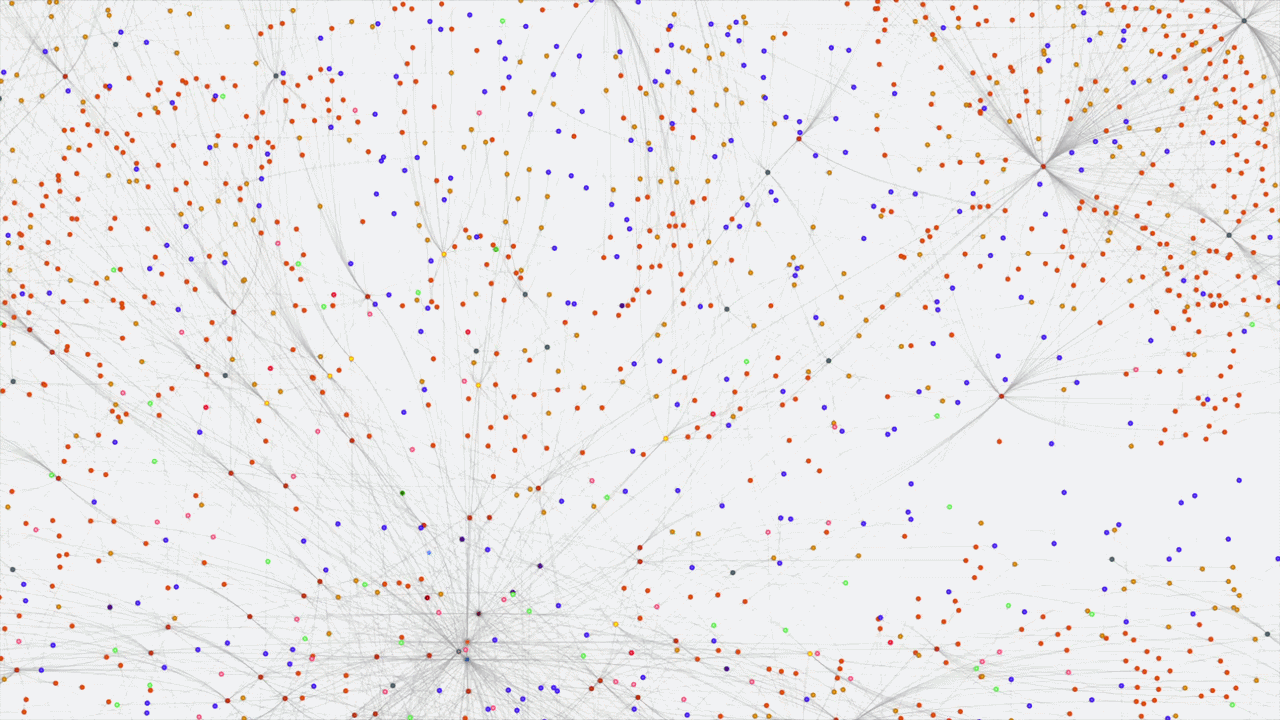
Our graph representation of an excerpt CityGML dataset of the HafenCity district in Hamburg.
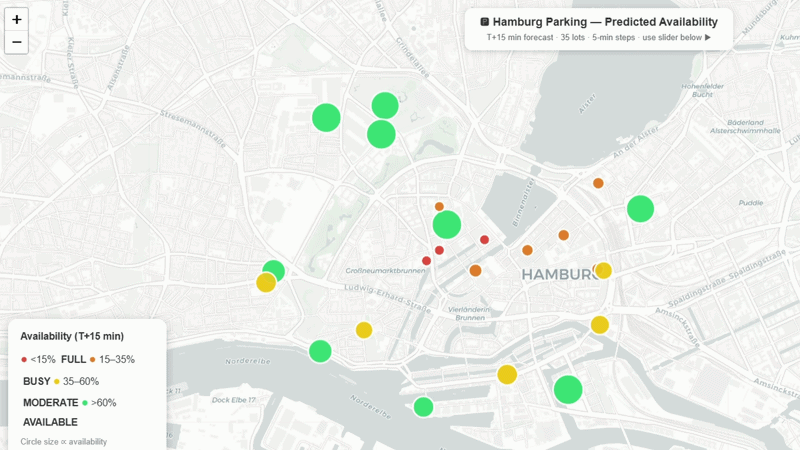
A Graph Neural Network system for predicting parking availability across Hamburg's public parking facilities
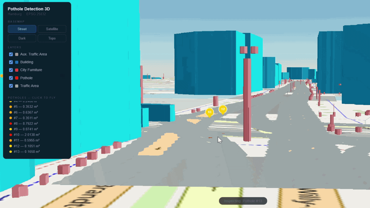
An interactive 3D web demo showcasing automated pothole detection on SVI from a district in Hamburg, Germany.
End-to-end pipeline for automatic building storey estimation from VGI to semantically enrich CityGML-based 3D city models.
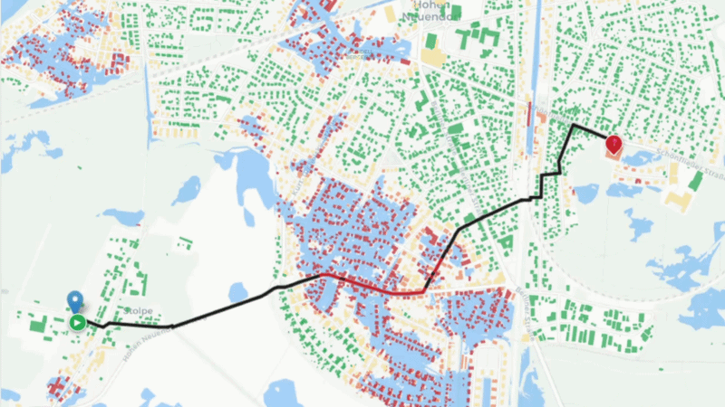
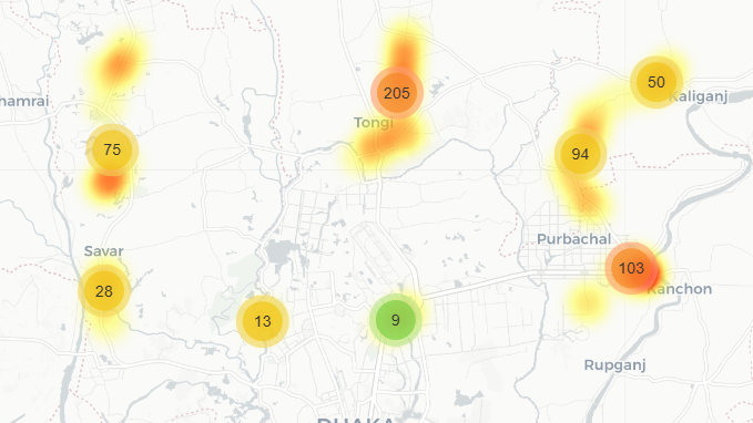
Graph-based pedestrian routing under flood conditions during the January 2024 Brandenburg flood.
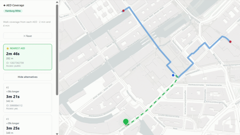
Network-based routing to the nearest automated external defibrillator with walk-time isochrone coverage.
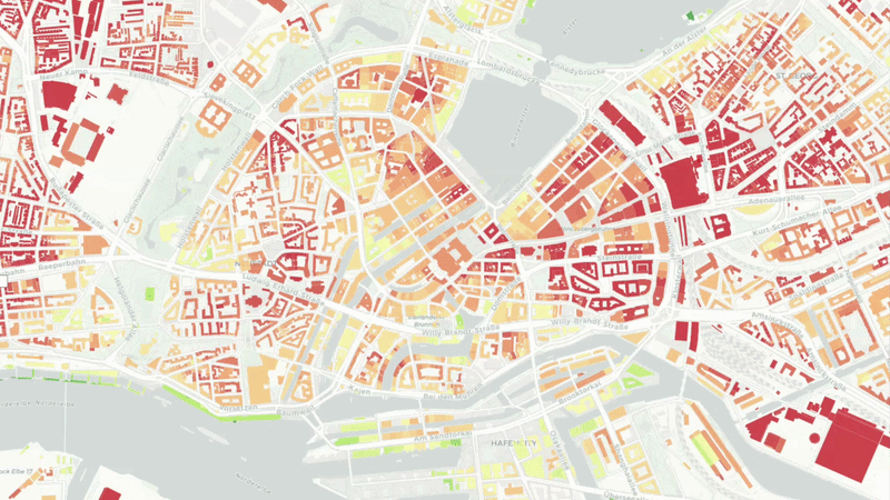
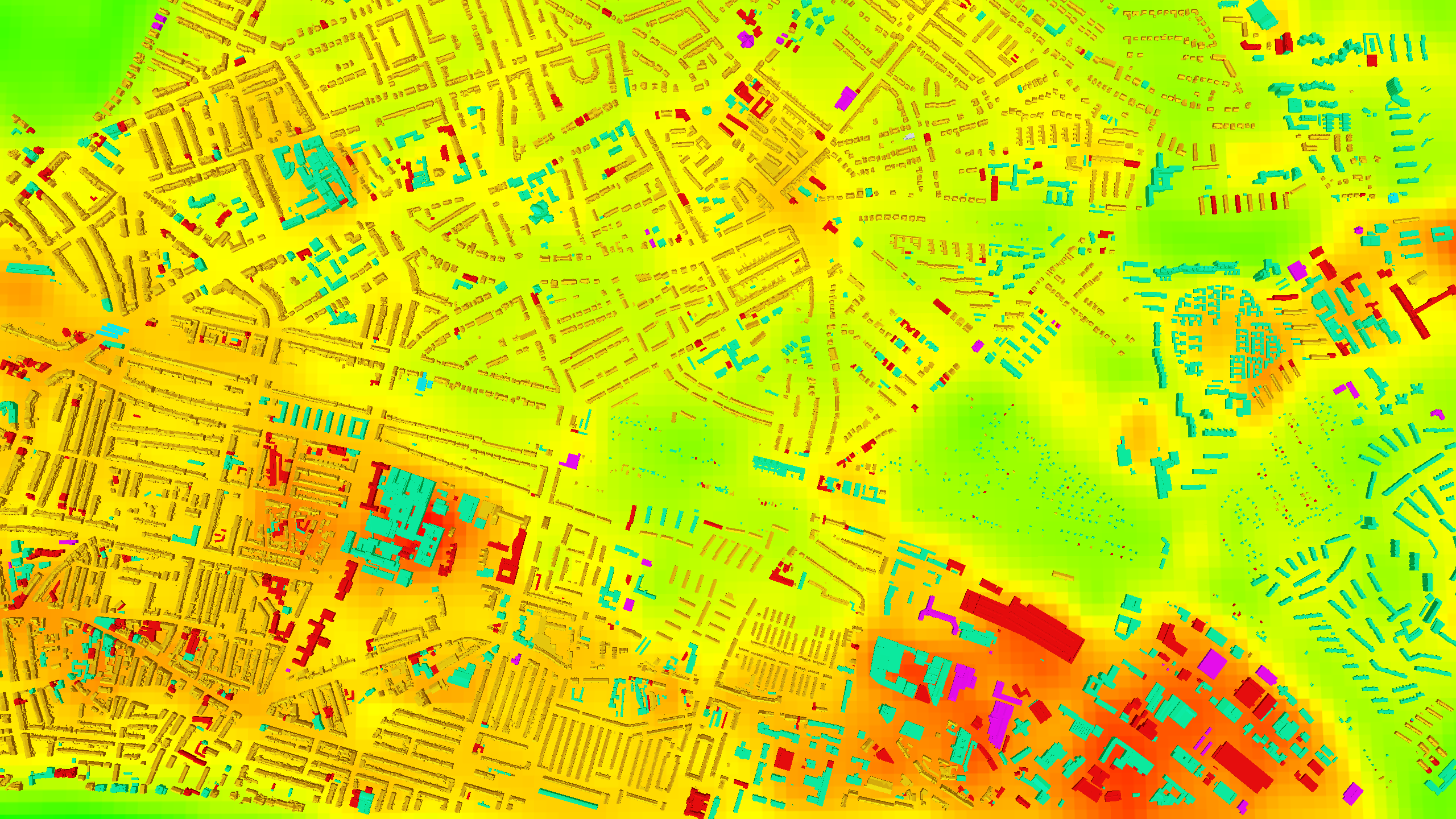
UHI simulation and visualisation of greening potential using roof-material predictions, from Hamburg, Germany.
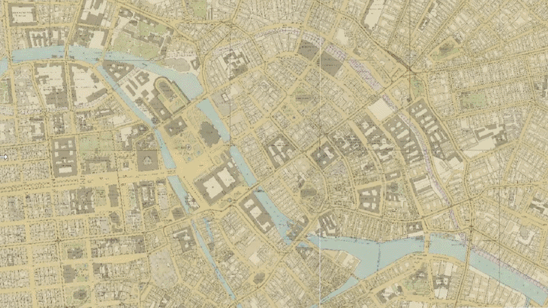
Interactive visualization of land-cover predictions for historical maps (Straube-Karten) of Berlin.
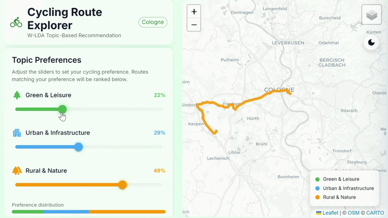
A semantic approach to personalised route recommendation using weighted topic modelling.
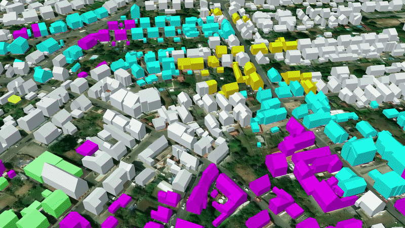
Interactive 3D visualization of buildings in Hamburg enriched with predicted roof materials.
Latest updates from our group — follow us on LinkedIn for more.
Recognition received by our group at international venues.
Openly licensed datasets with DOIs, standard metadata, and baselines.
| Dataset | Version | Size | License | DOI | Download |
|---|---|---|---|---|---|
| Benchmark Dataset for Indoor Electrical Utilities Object detection for power sockets and light switches |
2026-1.0 | 368.9 MB | CC BY 4.0 | 10.5281/zenodo.18835199 | Site · Mirror · Bib |
| Ingolstadt Roofmats CityGML3 CityGML 3.0 enriched with roof materials |
2026-1.0 | 56.0 MB | CC BY 4.0 | Pending | Site · Mirror · Bib |
| Ingolstadt Roofmats CityGML2 CityGML 2.0 enriched with roof materials |
2026-1.0 | 43.5 MB | CC BY 4.0 | Pending | Site · Mirror · Bib |
| Hamburg Roofmats CityGML2 CityGML 2.0 enriched with roof materials |
2025-1.0 | 6.5 GB | CC BY 4.0 | 10.5281/zenodo.18896534 | Site · Mirror · Bib |
| Hamburg Roofmats CityGML3 CityGML 3.0 enriched with roof materials |
2025-1.0 | 6.5 GB | CC BY 4.0 | 10.5281/zenodo.18896614 | Site · Mirror · Bib |
| Semantic Segmentation Dataset for Historical Maps Benchmark dataset for homogeneous corpora |
2025-1.0 | 52.7 MB | CC BY 4.0 | 10.5281/zenodo.17579452 | Site · Mirror · Bib |
| Rooftop Drainage Outlets and Ventilations Dataset Dataset for drainage detection on flat rooftops |
2025-1.0 | 62.5 MB | CC BY 4.0 | 10.5281/zenodo.14040571 | Site · Mirror · Bib |
Peer‑reviewed work from our group and collaborators.
We are a passionate group spanning ML/DL, Geospatial Data, and Knowledge Graphs.

Group Lead

Postdoc, Team Coordinator

PhD Student
PhD Student
PhD Student

PhD Student
Student Assistant

Student Assistant
Student Assistant
Student Assistant

Student Assistant
Ongoing research and development projects.
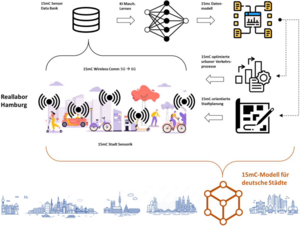
Lösungsansätze für die Mobilität der Zukunft, deren systemischer Ansatz eine innovative Funk- und Kommunikationsinfrastruktur mit einer daten- basierten Modellplattform für die 15-Minuten-Stadt und dem Anwendungsfall Notfallhilfe verbinden.

Tierschutz und Tierwohl in der Geflügelhaltung durch ein innovatives Mixed-Reality (MR)-System und entsprechende Lehrmaterialien für verschiedene Zielgruppen attraktiver und praxisnäher gestalten.
Aufbau eines Flowmanagement-Systems für Personenströme unter Einsatz innovativer Netztechnologien (5G) im Rahmen einer Kooperation mit weiteren Universitäten und der Deutschen Bahn.